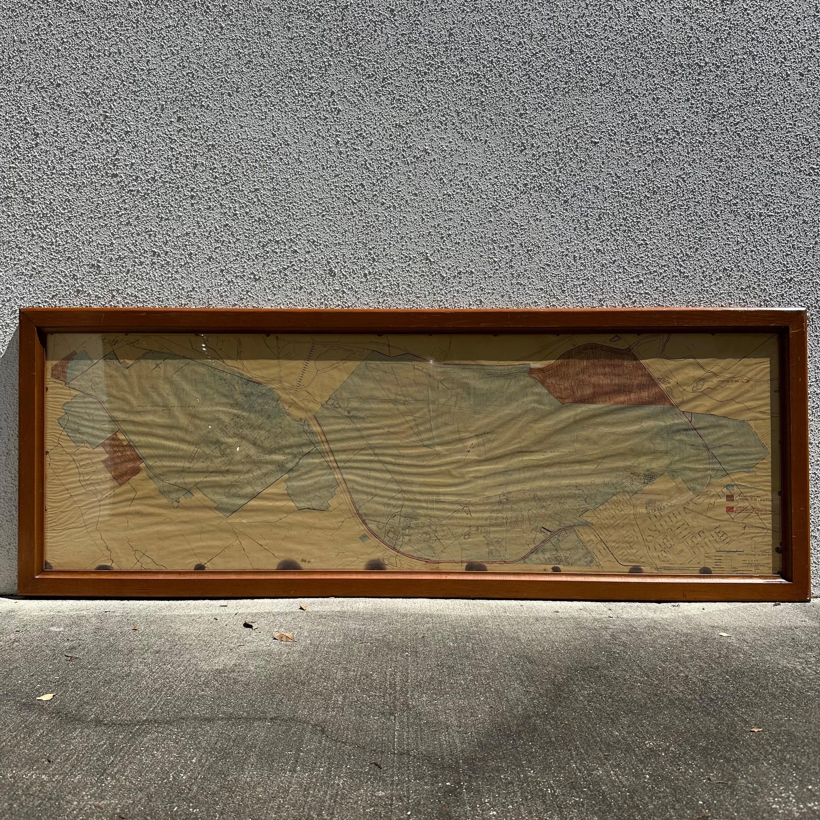
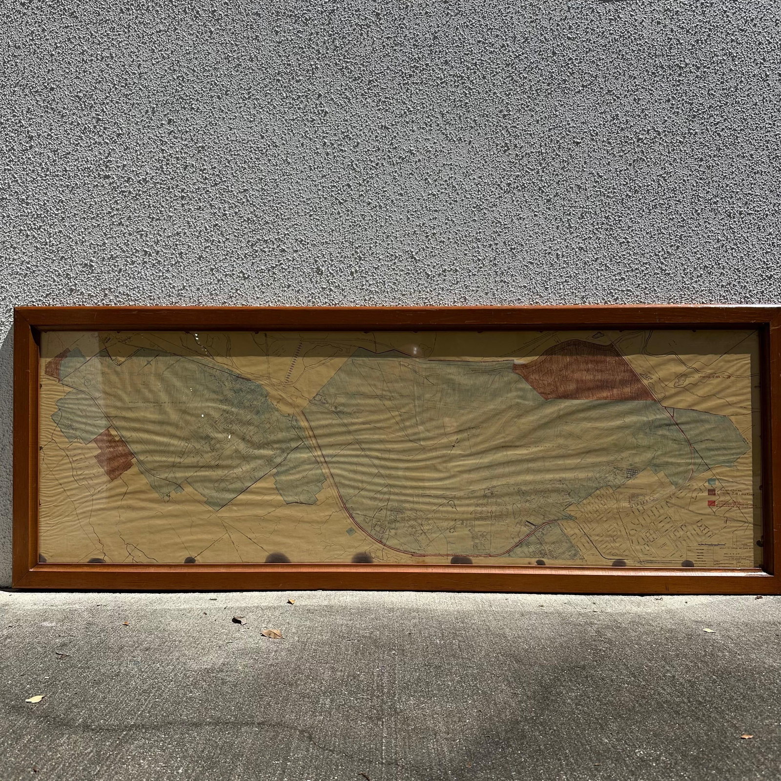
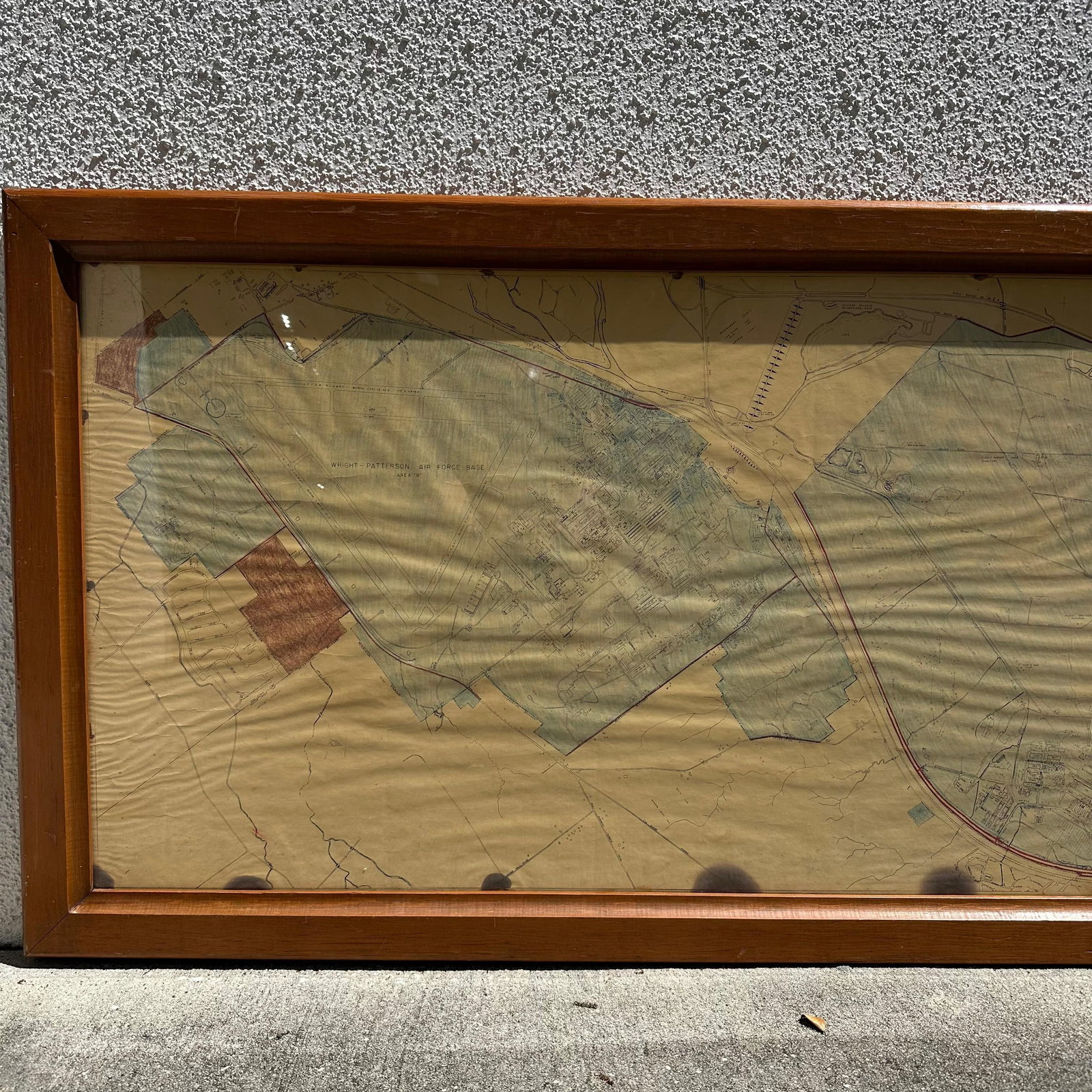
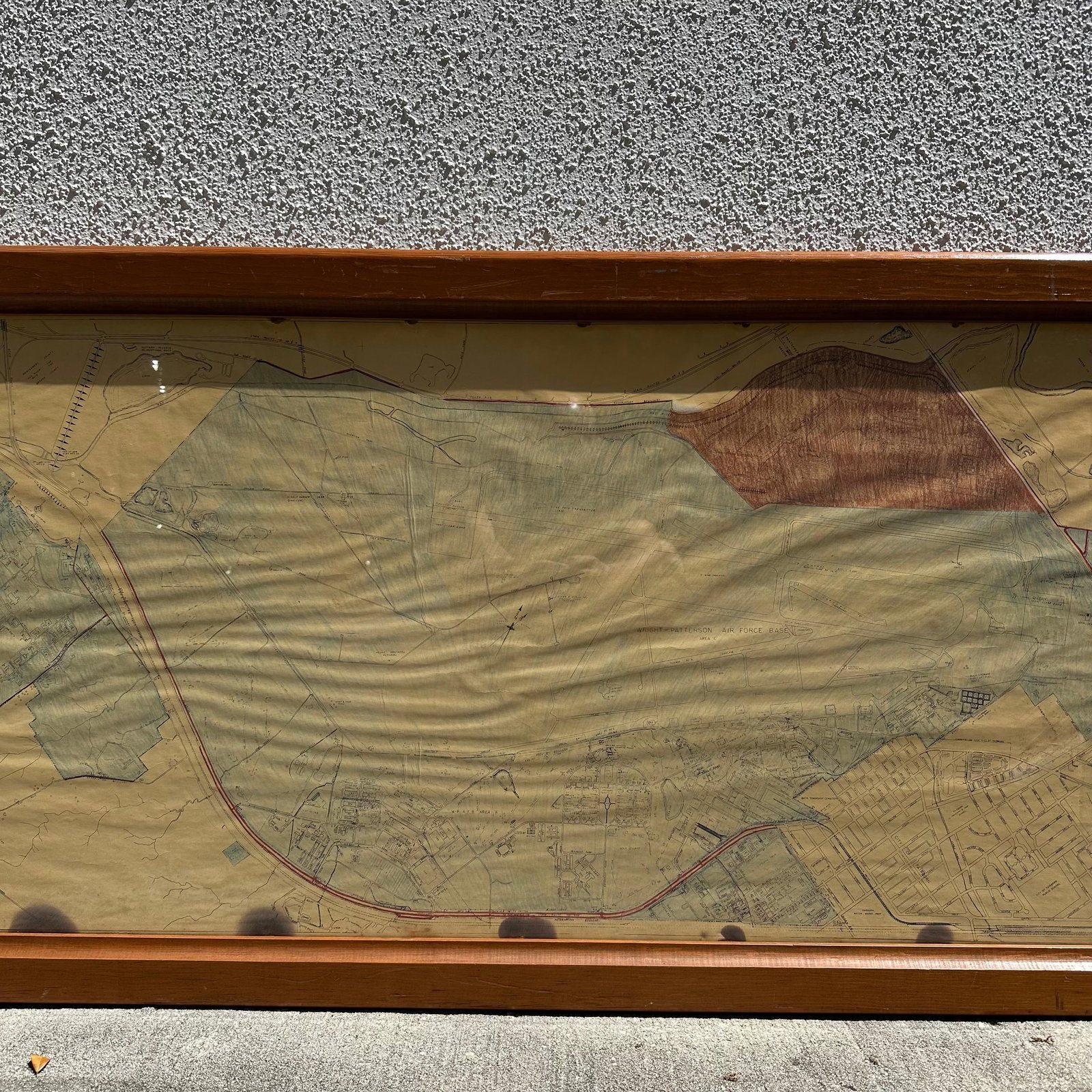
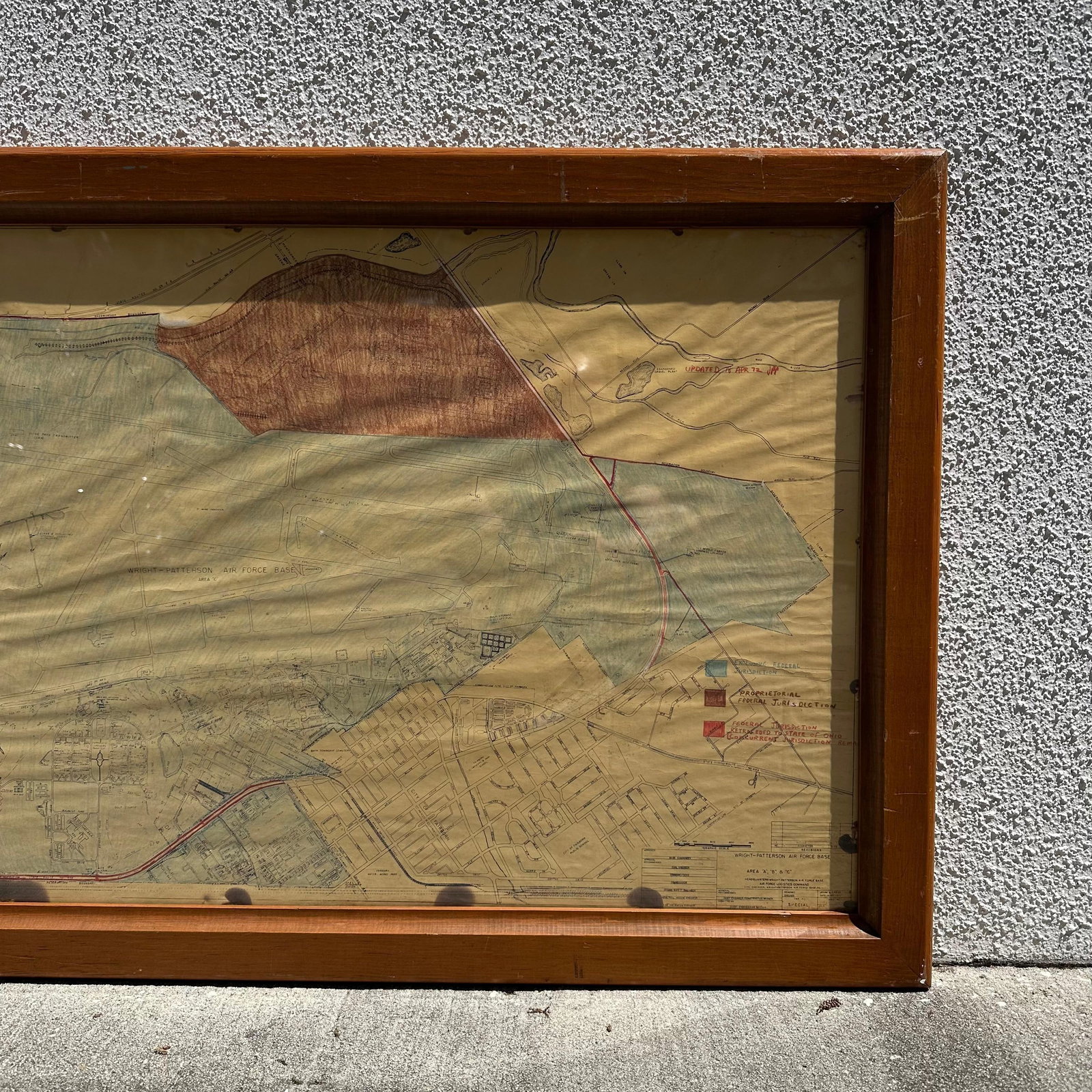
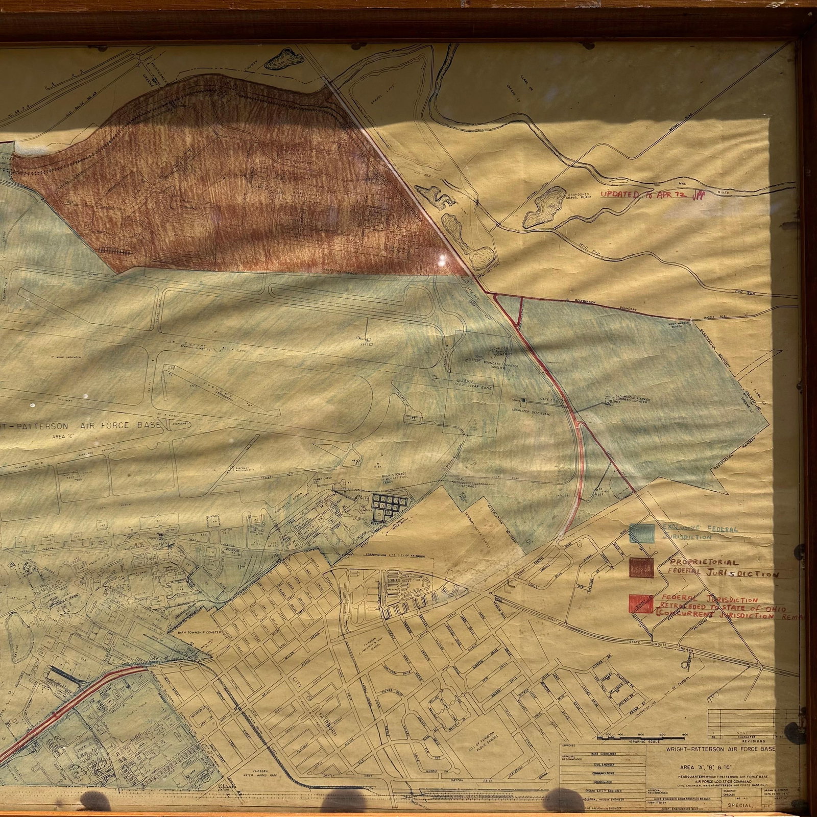
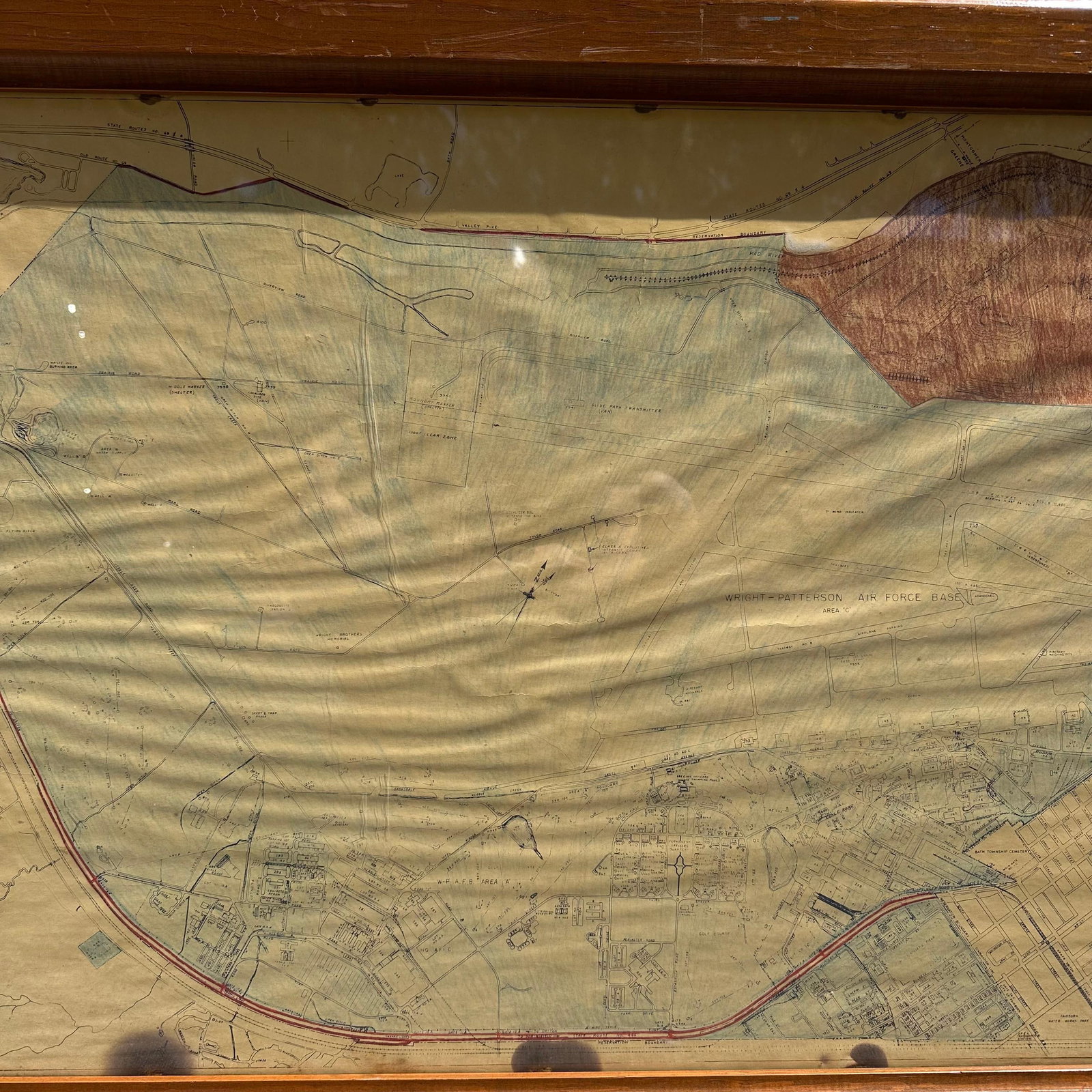
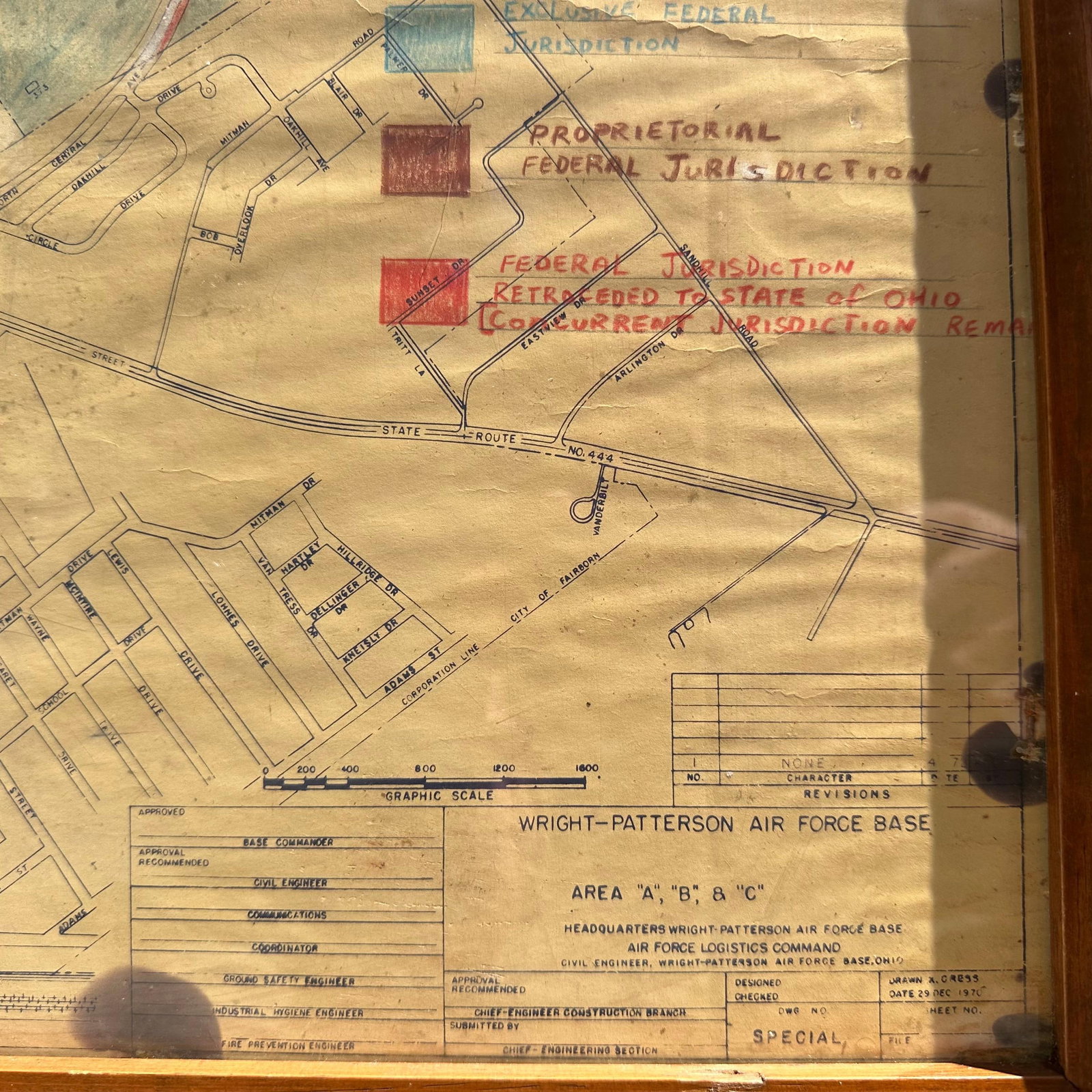
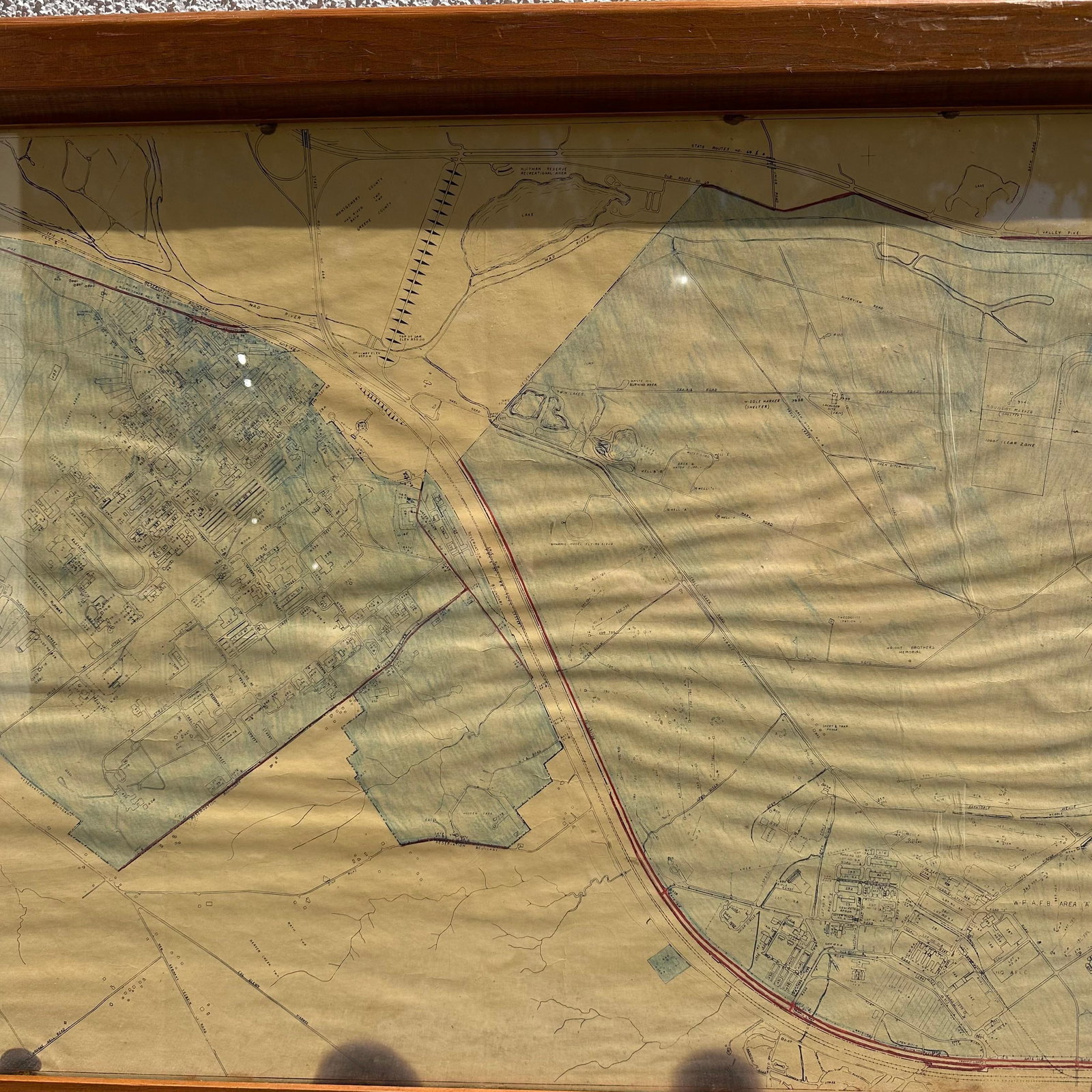
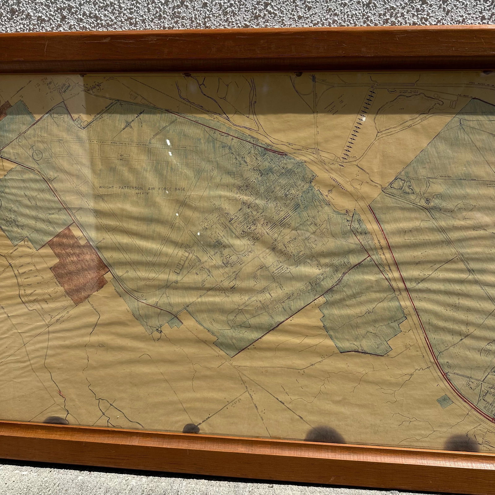
Offered here is an original large-format U.S. Air Force base planning map from Wright-Patterson Air Force Base, one of the most historically significant military installations in the United States. This hand-colored example is labeled “Area B” and is marked “Updated to Apr 72”, placing it firmly in the Cold War era.
Acquired from a former individual associated with the base.
According to the original owner, who worked on base for 12 years, this map was previously mounted and displayed on-site at Wright-Patterson Air Force Base, later removed and kept in a private residence for many years.
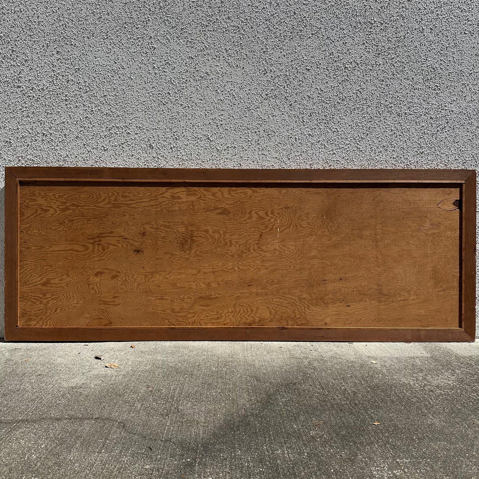
Visible wear consistent with age and use, Minor waviness/handling wear, No major losses observed, minor toning/staining/discoloring, Overall displays well and retains strong visual presence. Scratches seen along the plexiglass. Please reference all photos for full details.
Frame: 76 1/2" x 28 1/4" x 1 1/2". Weight: 25.5 lbs
Solid wood construction, heavy, large piece. Rare surviving example of a working U.S. Air Force installation map not originally intended for public distribution.
Share this lot:
